Miniera di Chuquicamata

Chuquicamata è una miniera di rame a cielo aperto, in cui un minerale relativamente povero di rame è estratto in quantità enormi. Le moderne tecnologie di fusione ed estrazione mineraria permettono l’uso di tali depositi a costi molto bassi. Il minerale contiene metalli tra 1,13% e 1,18%, di cui rame in maggior quantità, ma anche […]
Koohrang HPP , I. R. of IRAN
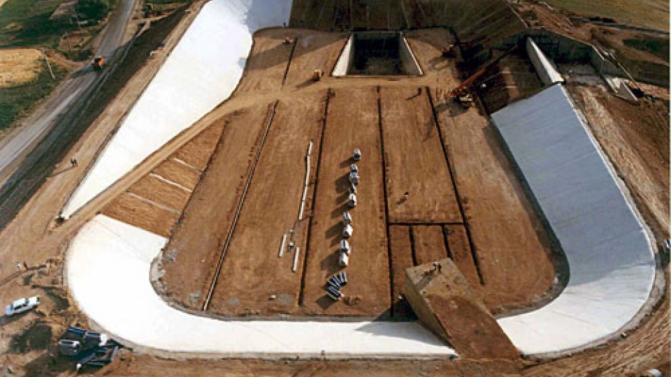
Project Name: Koohrang HPP Purpose of the projectGenerate: 128,000,000 Gwh/ y Electrical Energy Project location: IRAN-Shahre kord Client: I.W.P.C Contractor: Payab kosar – Canivo Dam Type: Earth Fill Dam Height above foundation: 15 m Crest level (above sea level): 2345.5 Crest length: 470 m Capacity of the Reservoir: 100,000 m<<3<< Foundation soil: SG-GC End of […]
Mujib Dam, Jordan
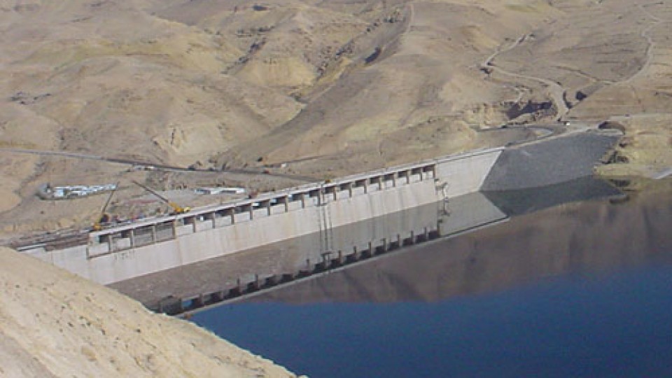
Project Name: Mujib Dam Purpose of the project: Irrigation and Water Supply Project location: Madaba Region Hashemite: Kingdom of Jordan Client: Jordan Valley Authority (JVA) Contractor:Aegek-Hydrogradnja J.V. Consultant:Lahamayer Dam Type: RCC with earthfill abutments (clay core) Height above foundation: 62 m Crest level: 199 m a.s.l. Crest length: 750 m Capacity of the Reservoir: 35 […]
Wala Dam, Jordan
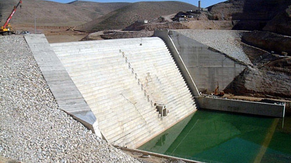
Project Name: Wala Dam Purpose of the project: Irrigation and Water Supply Project location: Madaba Region Hashemite: Kingdom of Jordan Client: Jordan Valley Authority (JVA) Contractor:Aegek-Hydrogradnja J.V. Dam Type:RCC with earthfill abutments (clay core) Height above foundation: 42 m Crest level: 524 m a.s.l. Crest length: 265 m Capacity of the Reservoir: 9.2 million cubic […]
Tangeh Halleh Dam, I.R. of Iran
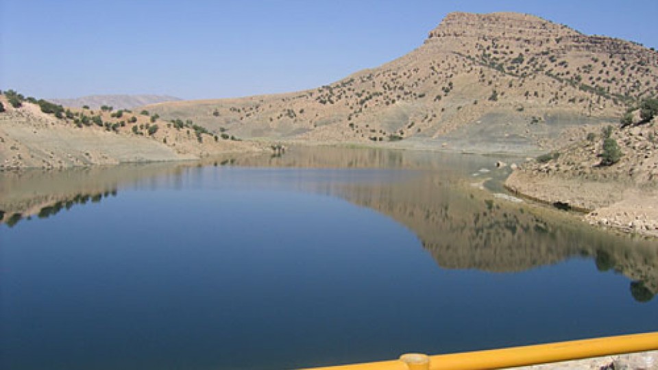
Project Name: Haleh Dam Scopo del progetto: Irrigazione Project location: IRAN – Lorestan-Khoramabad Client: GHARB Regional Water Authority Contractor: SAZVAR CO. Dam Type: Homogenous Earth Dam Height above foundation: 42.55(m) Crest level(above sea level): 1217 Crest length: 195 (m) Capacity of the Reservoir: 3500000 m3 Foundation soil: Rock (shale) End of construction: Nov 2003
Meijaran Dam, I.R. of Iran
Project Name: Meijaran Dam Project location: IRAN- RAMSAR Client: Mazandaran & Golestan Regional Water Authority Contractor:Cotra Co. Dam Type: Homogeneous(clay) Height above foundation: 32 (m) Crest level (above sea level): 153 (m) Crest length: 622 (m) Capacity of the Reservoir: 40,000,000 m3 End of construction: June 2004
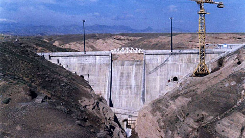
Diga di Ravedis, Italia
Nome del progetto: Diga di Ravedis Scopo del progetto: Controllo delle inondazioni, irrigazione ed energia Sede del progetto: Regione Friuli, Italia Cliente: Consorzio di Bonifica Cellina-Meduna Appaltatore: CORAV sponsor Impregilo S.p.a. Ingegnere: IN.CO. S.p.a. Tipo di diga: Calcestruzzo a gravità Altezza dalle fondamenta: 51 m Livello della cresta (sul livello del mare): 343 m Lunghezza […]
Komayestan Dam, I.R. of Iran
Project Name: Komayestan Dam Scopo del progetto: Irrigazione Project location: IRAN – Khorasan- Sabzevar Client: Khorasan Regional Water Authority Contractor: Kahar –e- Khorasan CO. Dam Type: Concrete gravity dam Height above foundation: 34.5 m Crest length: 835 m Capacity of the Reservoir: 1,200,000 m3 End of construction: February 2002
Golestan II Dam , I.R. of Iran
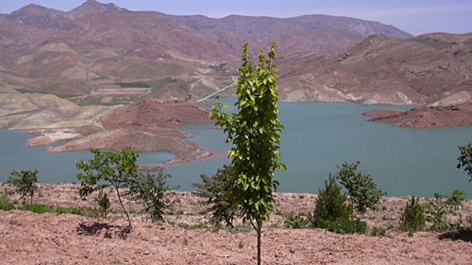
Nome del progetto: Diga Golestan II Scopo del progetto: Irrigazione Sede del progetto: IRAN-GOLESTAN Cliente: Mazandaran & Golestan Regional Water Authority Appaltatore: PORNAM CO. Tipo di diga: DIGA DI TERRA EMOGENA Altezza dalle fondamenta: 32 (m) Livello della cresta (sul livello del mare): 102m Lunghezza della cresta: 622 (m) Capacità del serbatoio: 36000000 m3 Fine […]
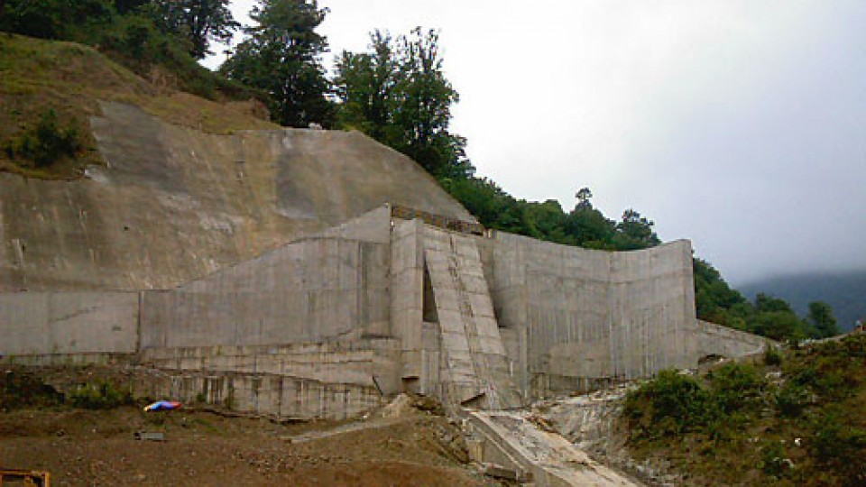
Tangab Dam, I.R. of Iran
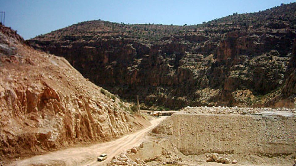
Project Name: Tangab Dam Purpose of the project: Irrigotion & Resort Area Project location: IRAN – Shiraz Client: FARS Regional Water Authority Contractor:EV- YOL CO. Dam Type: Rock Fill With Chimney Clay Core Height above foundation: 51 m Crest length: 270 m Capacity of the Reservoir: 130,000,000 m3 End of construction: Under Construction Will Be […]
Bidvaz Esfarayen Dam, Islamic Republic of IRAN
Project Name: Bidvaz Esfarayen Dam Purpose of the project: Agricolture & Irrigation Project location: Khorasan- Esfarayen Client: Khorasan Regional Water Authority Contractor: Gostaresh Nosazi Sanayee Iran CO. Dam Type: Earth Fill Dam With Clay Core Height above foundation: 60 (m) Crest level (above sea level): 1534 Crest length: 113 (m) End of construction: June 2005
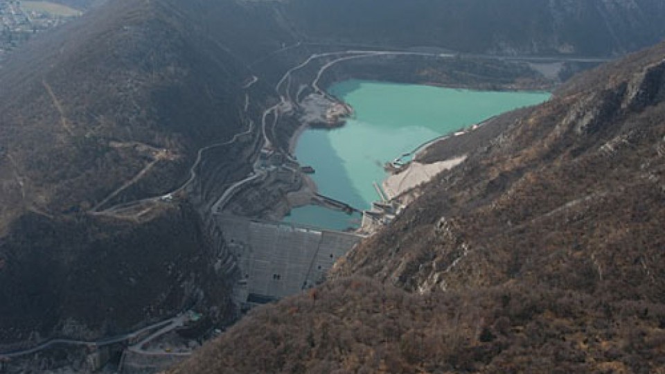
Mollasadra Dam – Iran
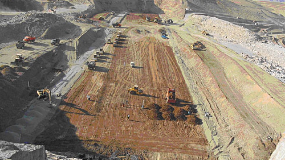
GENERAL INFORMATION Project Name: Mollasadra DamPurpose of the project: Agricultural & Energy productionProject location: IRAN – FARSClient: FARS Regional Water AuthorityContractor: Melli Sakhteman. CoDam Type: Earth Fill Dam With Clay CoreHeight above foundation: 72 mCrest level (above sea level): 2122 (m)Crest length: 630 mCapacity of the Reservoir: 440,000,000 m3End of construction January: 2006 INSTRUMENTS INSTALLED […]