Monitoring works for the 2014 Sochi Winter Olympic Games – Russia
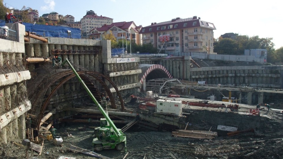
Sisgeo, thanks to the collaboration with its Russian partners AGT Systems and GPIKO, furnished and installed all the equipments necessary to monitor the most important road and railway works that are under construction in Sochi area, that is the neural centre of 2014 Winter Olympics.The monitored works are: retaining walls for the protection of roads, […]
Monitoraggio frana in località Molunghi
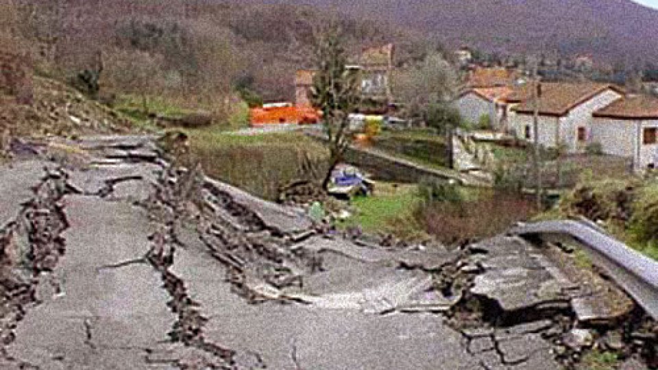
Studio e monitoraggio della frana di Molunghi Il progetto di monitoraggio della frana di Molunghi è stato svolto in collaborazione tra il Comune di Calice al Cornoviglio ed il Servizio Viabilità della Provincia della Spezia ed è iniziato a seguito del dissesto che ha colpito la strada provinciale e parte dell’abitato di Molunghi di Mezzo […]
FAQ#116 – How do I configure a WR-Log digital node to read RS485 Sisgeo TIMED sensors?
Sisgeo digital instruments can operate in two powering modes: TIMED or ALWAYS-ON (for more information see F.A.Q.#094).A string of mixed instruments consisting of TIMED gauges and ALWAYS-ON gauges cannot work.The first thing to do is therefore to check that ALL connected instruments in your array are set to TIMED mode.You can check the powering mode […]
FAQ#111 – Why I cannot read correctly my 4-20mA current loop gauge?
It could be a problem connected to the power supply given by the readout or logger. When the power supply is in the current loop (2-wire gauge) it is necessary to consider the effect of voltage drop across the shunt resistor on the voltage applied to the gauge. For example, suppose a 4-20mA gauge requires […]
FAQ#095 – How long does a chain of digital sensors take to be read?
It mainly depends from the powering mode of the gauges (refer to FAQ#094 for the description of the powering modes). AN EXAMPLE WILL BETTER CLARIFY THE ANSWER. In a batch of 240 gauges, unless otherwise requested by the Customer, the addresses are settled from #001 up to #240. In a borehole is installed a chain of 30 […]
FAQ#094 – Which are the available powering modes for SISGEO digital sensors?
All SISGEO digital gauges can be settled in two different powering mode: The STANDARD powering mode is ALWAYS ON, so unless otherwise requested by the Customer, the sensors are settled as default in ALWAYS ON.
FAQ#087 – Could the IPI, BH Profile and DEX probes have problems in frozen water?
Sisgeo suggest that frozen water within the inclinometer casings is to be avoided due to following reasons: – Ice within the casing will affect functionality of the systems by blocking the individual probes;– Mechanical damages can occur to the probes, but also to the inclinometer casing due to the expansion of frozen water In any […]
FAQ#075 – What parameters are saved in SISGEO digital sensors? What information must the Customer provide when ordering?
All SISGEO digital sensors (e.g. IPI, BH Profile, MD Profile, LT Inclibus, Tilt-meter, RDS, H-Level, etc.) use the Modbus communication protocol over RS-485 serial. SISGEO digital sensors are connected to each other with a single signal cable. The parameters that are configured at the factory for each digital sensor are as follows: Upon confirmation of […]
FAQ#074 – Che tipo di acquisitore è necessario per leggere i sensori digitalizzati SISGEO?
Per leggere i sensori digitalizzati SISGEO è necessario utilizzare un datalogger Modbus Master (es. OMNIAlog e miniOMNIAlog). I sensori sono letti mediante il cavo connesso ad un interfaccia RS-485 (DCE, Half-Duplex, no Echo) in grado di gestire il protocollo Modbus RTU SISGEO. La documentazione del protocollo Modbus SISGEO vi è disponibile sul sito SISGEO. E’ […]
FAQ#073 – Qual è il numero massimo di sensori digitalizzati (RS-485, modbus), il numero massimo di catene e la distanza massima del cavo di collegamento in una rete RS-485?
Ultimo aggiornamento: ottobre 2021 Tutti i sensori digitalizzati SISGEO utilizzano il una interfaccia RS485 con protocollo Modbus. 1. Il numero massimo di sensori digitalizzati in una rete RS-485 è 247 (teorico). 2. Il numero massimo di catene di sensori digitalizzati collegabili ad un Modbus master (OMNIAlog e miniOMNIAlog) è 4. 3. Per le distanze massime […]
Stazione della metropolitana di Genova – Italia
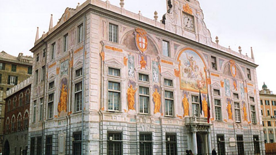
Questa tratta della metropolitana di Genova migliorerà il trasporto sia verso il Centro Espositivo del Porto Antico di Genova che verso il nuovo Acquario, migliorando nel frattempo sia le condizioni di traffico che la riorganizzazione della rete di trasporto di superficie. I lavori hanno richiesto importanti opere preliminari di consolidamento del terreno e sono stati […]
Tangab Dam, I.R. of Iran
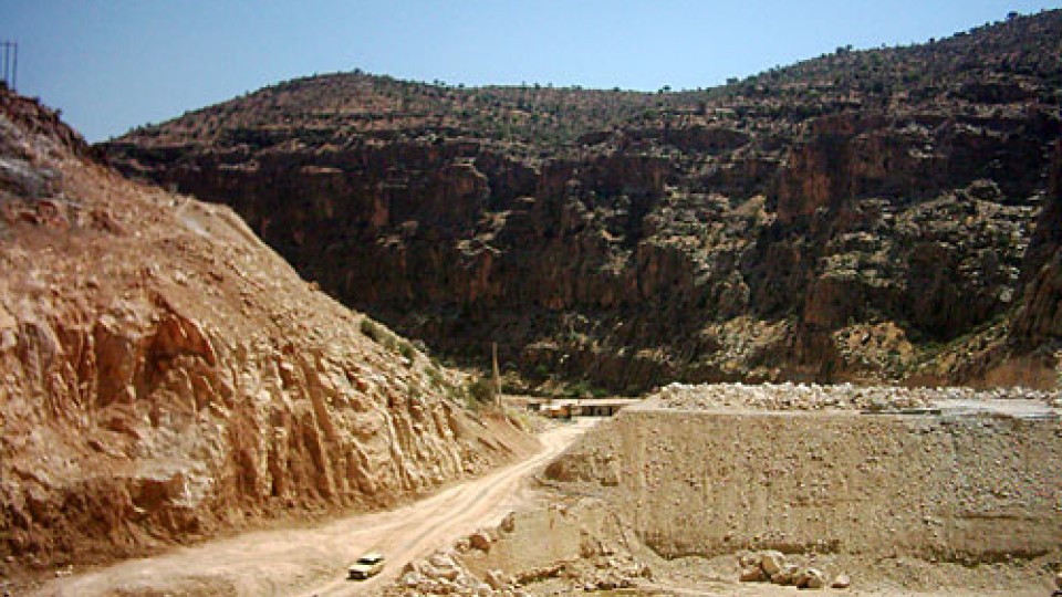
Project Name: Tangab Dam Purpose of the project: Irrigotion & Resort Area Project location: IRAN – Shiraz Client: FARS Regional Water Authority Contractor:EV- YOL CO. Dam Type: Rock Fill With Chimney Clay Core Height above foundation: 51 m Crest length: 270 m Capacity of the Reservoir: 130,000,000 m3 End of construction: Under Construction Will Be […]